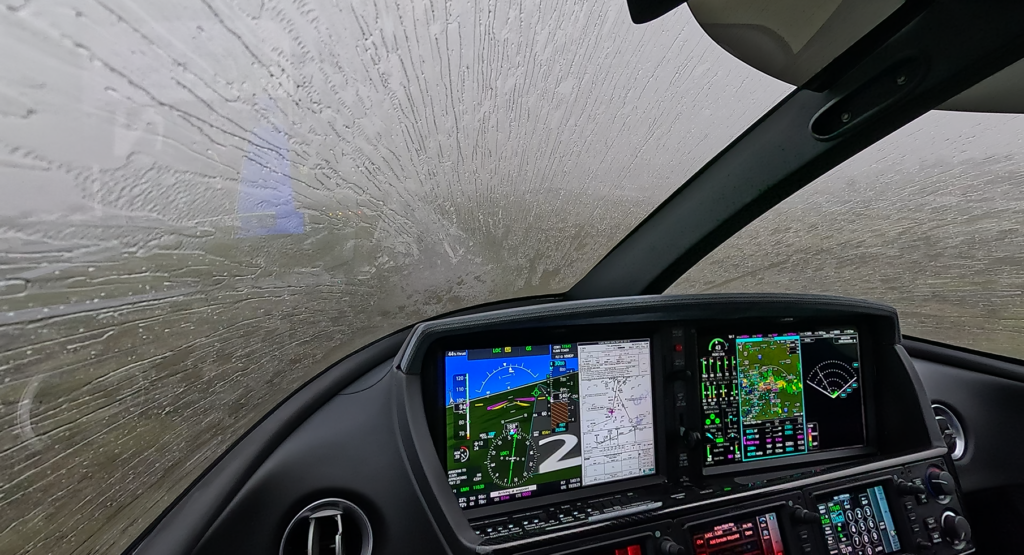
For Vision Jet pilots flying with the Garmin Perspective Touch+ avionics, both SiriusXM Weather and FIS-B (Flight Information Services-Broadcast) provide valuable weather information. However, the two systems deliver weather very differently, and those differences become important on longer cross-country flights and when making strategic weather decisions.
This article discusses strategic weather information, but we need to also discuss the value of tactical weather information, briefly.
Weather information displayed through NEXRAD, SiriusXM, or FIS-B is designed for strategic decision-making, not tactical weather avoidance. These systems provide a valuable big-picture view of developing weather systems, allowing pilots to identify trends, evaluate routes, select alternates, and make early decisions to avoid areas of concern. However, data-link weather has inherent latency because the information must be collected by ground radar, processed, transmitted, received, and displayed in the cockpit. The image you see may already be several minutes old, and rapidly developing thunderstorms can change significantly during that time.
An onboard weather radar system serves a different purpose by providing tactical weather information—a real-time picture of precipitation directly in front of the aircraft, provided tilt, range, and calibration are correct. This allows pilots to evaluate the intensity, movement, and proximity of weather cells while making short-term decisions such as deviations and avoidance maneuvers. Relying solely on NEXRAD or FIS-B when operating near convective weather, attempting to navigate between cells, or making close-in deviations can place a pilot at risk because the display may not accurately represent the current conditions along the flight path. The safest approach is to use data-link weather to develop a strategic plan well before encountering hazardous weather and use airborne radar, visual observations, and conservative decision-making when tactical weather avoidance is required. A pilot who substitutes strategic weather for tactical awareness when operating near thunderstorms is relying on a delayed picture of a rapidly changing environment. This is dangerous… Likewise, viewing strategic and tactical weather information simultaneously, and on a consistent basis, provides pilots with a higher level of experience, over time, that results in a better interpretation of weather patterns, storm movement, and weather intensity you would not get if only using one or the other. Again, this article focuses on strategic weather information.
At a Glance
| Feature | SiriusXM Weather | FIS-B Weather |
|---|---|---|
| Cost | Monthly subscription | Free |
| Transmission | Satellite | FAA ADS-B ground stations |
| Coverage | Coast-to-coast, including offshore and much of Canada | Continental U.S. only |
| Reception | Available from engine start to shutdown with an unobstructed satellite view | Requires line-of-sight to ADS-B ground stations |
| Low Altitude Performance | Excellent | May be limited on the ground and at low altitude |
| Radar Resolution | High-resolution nationwide | Regional high-resolution near the aircraft; lower-resolution CONUS farther away |
| Weather Products | Extensive | More limited |
| Lightning Data | Cloud-to-cloud and cloud-to-ground | Cloud-to-ground only |
| Icing Products | Observed icing products available | Forecast icing products |
| Turbulence | Graphical turbulence guidance | Limited |
| Subscription Required | Yes | No |
SiriusXM generally offers broader coverage, more weather products, and more consistent availability, while FIS-B provides an impressive amount of weather information at no recurring cost.
Coverage
The biggest operational difference is how the weather reaches the airplane.
SiriusXM
SiriusXM broadcasts weather directly from satellites. As long as the receiver has a view of the satellite, weather is available almost immediately after powering the avionics.
Advantages include:
- Available before takeoff
- Available after landing
- Excellent coverage at all cruise altitudes
- No dependence on nearby ground stations
- Consistent reception over water and in remote areas where supported by the service footprint
FIS-B
FIS-B weather is transmitted from the FAA’s nationwide ADS-B ground station network.
Because it is a line-of-sight system, reception depends on:
- Aircraft altitude
- Terrain
- Distance from ADS-B transmitters
Pilots frequently notice weather disappearing:
- While taxiing
- During low-level operations
- In mountainous terrain
- During descents into valleys
Once climbing through several thousand feet AGL, reception typically becomes very reliable.
Radar Quality
SiriusXM
SiriusXM provides high-resolution composite NEXRAD across the country with frequent updates. Many subscription levels also include:
- Base reflectivity
- Storm cell attributes
- Radar site status
- Echo tops
- Cloud tops
- Lightning
- Turbulence
- Freezing levels
- Icing products
FIS-B
FIS-B provides:
- Regional NEXRAD (higher resolution near the aircraft)
- CONUS NEXRAD (lower resolution nationwide)
As you zoom farther away from your aircraft, the display often changes to the lower-resolution national mosaic, making precipitation appear blockier and less detailed.
Weather Products
SiriusXM Includes
- NEXRAD
- METARs
- TAFs
- AIRMETs/SIGMETs
- PIREPs
- Lightning
- Echo Tops
- Cloud Tops
- Turbulence
- Freezing Levels
- Icing
- Surface analysis
- Forecast products
- Many additional graphical products depending on the subscription level.
FIS-B Includes
- NEXRAD
- METARs
- TAFs
- PIREPs
- SIGMETs/AIRMETs
- Winds Aloft
- TFRs
- NOTAMs (limited by proximity)
For many VFR and IFR flights, these products are sufficient, but they do not match the breadth of SiriusXM’s offerings.
Reliability During Flight
For a Vision Jet operating between FL280 and FL310, both systems generally perform well.
The differences become apparent:
- Before departure
- During climb
- During descent
- At lower altitudes
- In mountainous terrain
Because SiriusXM does not depend on ADS-B ground stations, pilots are less likely to experience interruptions while maneuvering or descending.
Integration with Garmin Perspective Touch+
Garmin Perspective Touch+ allows pilots to select the active weather source from the Weather Data Link page when multiple sources are installed. The display also shows the selected provider (such as SiriusXM or FIS-B) and the age of weather products. Pilots can configure NEXRAD presentation differently depending on the source—for example, composite versus base reflectivity for SiriusXM, or CONUS, Regional, or Combined views for FIS-B.
Which Should You Choose?
FIS-B is an excellent choice if you:
- Fly primarily within the continental United States.
- Want quality weather with no subscription cost.
- Mostly fly day trips or shorter cross-country flights.
- Operate from areas with good ADS-B coverage.
SiriusXM is worth the investment if you:
- Frequently fly long cross-country missions.
- Operate in rapidly changing weather.
- Fly at night or in IMC.
- Value continuous weather from engine start to shutdown.
- Want advanced weather products such as lightning, cloud tops, echo tops, turbulence, and observed icing.
A Note on Safety
Regardless of the source, both SiriusXM and FIS-B provide strategic weather information—not tactical weather guidance. The displayed NEXRAD imagery has inherent delays because the data must be collected, processed, transmitted, received, and rendered before appearing on the display. Garmin specifically cautions pilots not to use data link weather for maneuvering in, near, or around hazardous weather, and not to rely solely on the displayed product age because the underlying weather may already be significantly older.
Bottom Line
For many Vision Jet owners, FIS-B offers exceptional value because it’s free and integrates seamlessly with Garmin Perspective Touch+. However, SiriusXM remains the premium solution, delivering more complete weather information, broader coverage, and greater reliability throughout every phase of flight. If you routinely fly long IFR trips or depend on comprehensive weather situational awareness, the additional capability of SiriusXM can provide a meaningful operational advantage.
Let’s Connect
Whether you’re looking for a contract pilot, Supervised Operating Experience – SOE mentor, or long-term operational partner, SF50 Flight Support provides the reliability and expertise your Vision Jet deserves.
📍 Based in the Nashville area — supporting Vision Jet operations nationwide.
📧 Contact us today to discuss your upcoming flight needs. Call or text (615) 543-8553 or schedule a call.
For more video content, check out our – YouTube channel.